92 Victorian Reproduction County Maps
A3 (420x297mm) printed black on parchment-like paper
The 92 informative Victorian maps, superbly reproduced at approximately 150% original size, cover the whole UK and show sufficient detail and features to be of real use to researchers, detectorists, family historians and anyone interested in how their county looked over 125 years ago. The scale is around 5 miles to the inch varying according to the size of the county.
The maps for England and Wales come from Thomas Dugdale’s Curiosities of Great Britain (1846) and are by the renowned mapmaker Joshua Archer. They contain an abundance of information such as detailing the Hundreds, market towns, manors, polling places, roads, rivers, canals, mail coach routes and the few railways that existed at the time. Also included are many castles, abbeys, priories, Roman sites and even some coin hoards.
The maps for Scotland, which detail all the parishes, and Northern Ireland, which detail the baronies, come from two Philip’s Atlases published in 1882 and 1883 and are by another famous mapmaker, John Bartholomew.
The Channel Islands and Isle of Man maps come from The National Gazeteer published in 1868.
•Aid your research to find better sites
•Look really good framed
•Make great presents or prizes
•Supplied unfolded
PRICE: £2.50 each
Post & packing £1.50 on orders up to & including £20.00
Free delivery on all orders over £20.00
To purchase please click on appropriate buttons below
or click here for order form
ENGLAND AND WALES
| 1 Anglesey | ||
| 2 Bedfordshire | ||
| 3 Berkshire | ||
| 4 Brecknockshire | ||
| 5 Buckinghamshire | ||
| 6 Cambridgeshire | ||
| 7 Cardiganshire | ||
| 8 Carmarthenshire | ||
| 9 Carnarvonshire | ||
| 10 Cheshire | ||
| 11 Cornwall | ||
| 12 Cumberland | ||
| 13 Denbighshire | ||
| 14 Derbyshire | ||
| 15 Devonshire | ||
| 16 Dorset | ||
| 17 Durham | ||
| 18 Essex | ||
| 19 Flintshire | ||
| 20 Glamorgan | ||
| 21 Gloucestershire | ||
| 22 Hampshire (with Isle of Wight) | ||
| 23 Herefordshire | ||
| 24 Hertfordshire | ||
| 25 Huntingdonshire | ||
| 26 Kent | ||
| 27 Lancashire | ||
| 28 Leicestershire | ||
| 29 Lincolnshire | ||
| 30 Merionethshire | ||
| 31 Middlesex (with London) | ||
| 32 Monmouthshire | ||
| 33 Montgomeryshire | ||
| 34 Norfolk | ||
| 35 Northamptonshire | ||
| 36 Northumberland | ||
| 37 Nottinghamshire | ||
| 38 Oxfordshire | ||
| 39 Pembrokeshire | ||
| 40 Radnorshire | ||
| 41 Rutland | ||
| 42 Shropshire | ||
| 43 Somerset | ||
| 44 Staffordshire | ||
| 45 Suffolk | ||
| 46 Surrey | ||
| 47 Sussex | ||
| 48 Warwickshire | ||
| 49 Westmoreland | ||
| 50 Wiltshire | ||
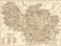
| 51 Worcestershire | ||
| 52 Yorkshire: North Riding | ||
| 53 Yorkshire: Parts of East & West Riding | ||
| 54 Yorkshire: West Riding | ||
| 55 Yorkshire: Part of North Riding | ||
| SCOTLAND | ||
| 56 Aberdeen | ||
| 57 Argyll and Bute | ||
| 58 Ayr | ||
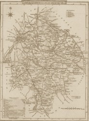
| 59 Banff | ||
| 60 Berwick | ||
| 61 Caithness | ||
| 62 Dumbarton | ||
| 63 Dumfries | ||
| 64 Edinburgh | ||
| 65 Elgin and Nairn | ||
| 66 Fife and Kinross | ||
| 67 Forfar | ||
| 68 Haddington | ||
| 69 Inverness (Mainland) | ||
| 70 Western Islands (Parts of Ross and Inverness) | ||
| 71 Kincardine | ||
| 72 Kirkcudbright | ||
| 73 Lanark | ||
| 74 Linlithgow | ||
| 75 Orkney and Shetland | ||
| 76 Peebles | ||
| 77 Perth | ||
| 78 Renfrew | ||
| 79 Ross (Mainland) and Cromarty | ||
| 80 Roxburgh | ||
| 81 Selkirk | ||
| 82 Stirling & Clackmannan | ||
| 83 Sutherland | ||
| 84 Wigtown | ||
| NORTHERN IRELAND, CHANNEL ISLANDS AND ISLE OF MAN | ||
| 85 Channel Islands | ||
| 86 Isle of Man | ||
| 87 Antrim | ||
| 88 Armagh | ||
| 89 Down | ||
| 90 Fermanagh | ||
| 91 Londonderry | ||
| 92 Tyrone |
TO SEE IMAGES AND DESCRIPTIONS OF INDIVIDUAL MAPS
PLEASE VISIT MY EBAY SHOP: Http://stores.ebay.co.uk/True-Treasure-Books